Alternatives to Google Maps
Table of Contents
- The problem with Google Maps
- Uses for Google Maps
- Tradeoffs, and Google's scale advantage
- Alternative mapping software reviewed
- Sources
The problem with Google Maps
If you are comfortable with Google knowing every location you're interested in looking at, going to, or saving, then this article might not be of much use to you.
Uses for Google Maps: The ultimate atlas
Google Maps isn't just your GPS navigation - there are multiple ways to use Google Maps.
For most, Google Maps gives turn-by-turn instructions when driving, walking, or using public transportation. Work, home. Work, grocery store, home. Even if we know the way by heart, we can stay up-to-date on traffic congestion, accidents, and more. To some, no matter where they're going, Google Maps is front and center on the infotainment screen.
Google Maps is also a way to discover new businesses, read customer reviews, book reservations, or look at a store's hours. This is ostensibly how Google makes their money from Google Maps, and it has become the modern day Yellow Pages. How else have you found out a business's hours in the last 15 years, besides web searching it (which even then, usually includes a Google Maps module/embed showing the hours)?
But in a more general sense, Google Maps is the lens through which most of us understand our planet, our cities, and where we live. It's the birds-eye view of everything. Some people, myself included, spend hours at a time zooming through cities and neighborhoods, analyzing highway networks, understanding downtown layouts, looking at remote wilderness in the Canadian territories, or checking out what life is like in street view in a random town in Ecuador or Pakistan. When a world news story breaks which prominently involves a location I'm unfamiliar with, I can go to Google Maps to gain a spatial understanding of it, and as a result, further understand what's going on in our world. It humanizes all of these people and communities and civilizations different to our own by giving us a street-view glimpse into their lives. It sometimes feels like the world is smaller as a result - familiar, knowable, not a mysterious colorful boundary on a desk globe, but just another location to zoom in on and understand in staggering satellite detail. It is the ultimate atlas.
Can anything replace such a detailed, data-rich documentation of the planet? Who, besides Google, would be incentivized to take on such a task?
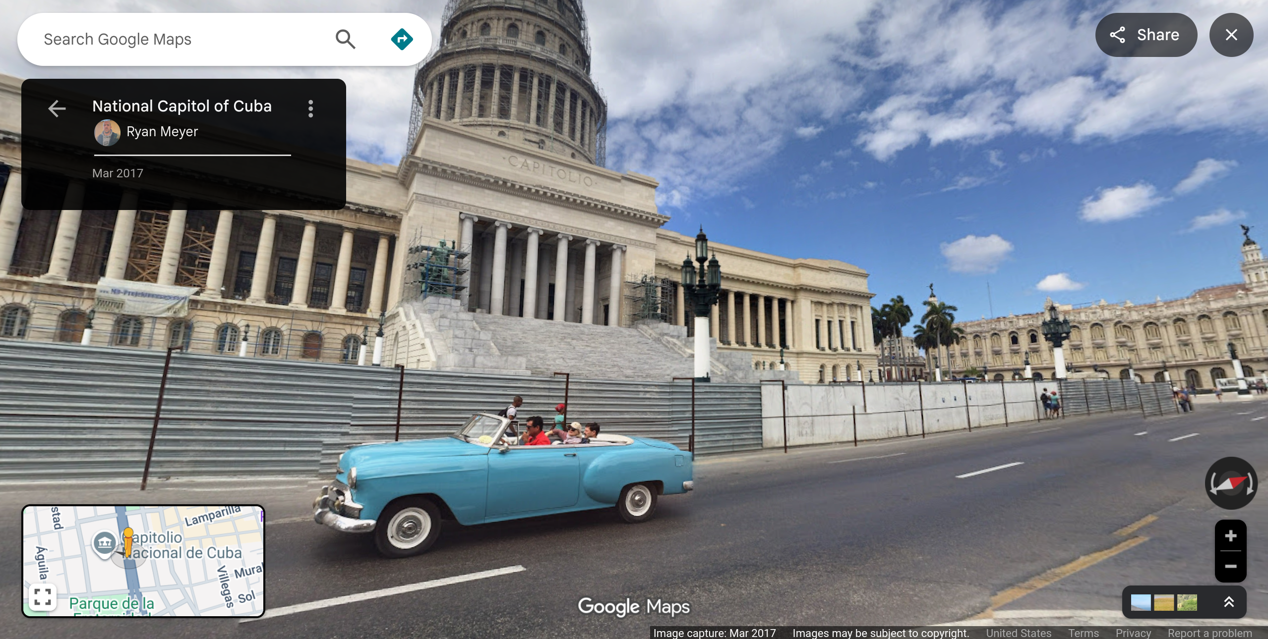 Life in Havana. A 1950s Chevrolet drives in front of the Cuban Capitol building, bringing to mind trade embargos, a unique car culture, and mechanical ingenuity.
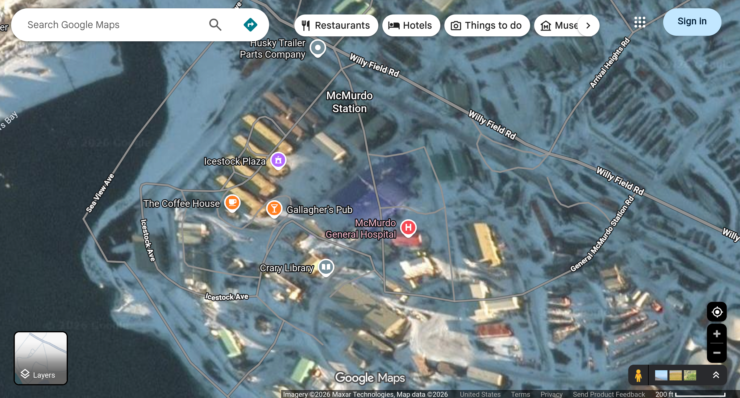 McMurdo Station, the largest community in Antarctica. The Coffee House and Gallagher's Pub icons spark thoughts of what life must be like for the 1,000+ summer residents living in this cold, faraway corner of Earth.
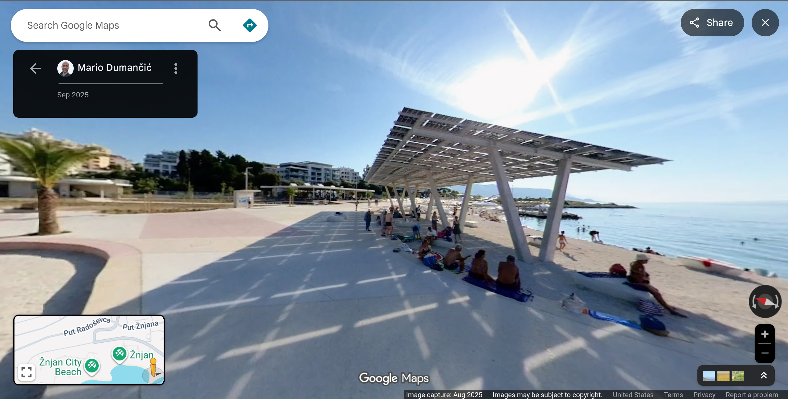 Beachgoers in Split, Croatia relax under a solar panel shade covering.
Tradeoffs, and Google's scale advantage
The good news: Whatever your reasons are for using Google Maps, there's alternatives!
The bad news: None of them even score a B-minus compared to Google Maps. There is a price for privacy, and your app of choice in this section will be based off of whatever tradeoff you can stomach.
What features does Google Maps really offer, and how replicable are they, either by other tech companies, or open-source, community efforts?
Road networks
Believe it or not, road networks are the most trivial feature to build out. OpenStreetMap is an amazing map database which is maintained by volunteers and kept open-source and freely licensed. It is the de facto standard for maps in the free software community which is maintained by volunteers and kept open-source and freely licensed. Most of the clients we'll explore are built upon OSM's backend.
Satellite imagery
Satellite imagery is a bit trickier. It's not very useful for mapping yourself to a restaurant you're meeting friends at, but it is a vital tool to understand the world. As far as I know, Google no longer captures any of the aerial imagery itself - these come from data use agreements with third parties, who operate satellites and planes. An information bar at the bottom of the page reads:
Imagery ©2026 Airbus, CNES / Airbus, Landsat / Copernicus, Maxar Technologis, Map data ©2026 Google
So we have:
- Airbus, satellites and presumably planes
- NASA, Landsat satellites
- ESA, Copernicus satellites
- Maxar (now Vantor/Lanteris). They operate the WorldView and GeoEye-1 satellites.
- Planet Labs / Terra Bella. They operate the SkySat satellites, 21 in total, 15 remain in orbit. Formerly owned by Google
Additionally, Google does post-processing using methods like orthorectification, compositing, and mosaicking to stitch and normalize all the data into a continuous, usable map.
Business and location information
Something about business data here
Real-time route data and congestion
Congestion and real-time route data - something about network effect - the cost of privacy
Street view
The hardest feature to replace is Google Maps's street view. Due to the continual effort of the Google Street View cars, some areas have a dozen passes of the same locations, which you can choose to view historically. If an area doesn't have a street view, the assumption is more often that the area is legally or logistically inaccessible, rather than Google "not getting around to it."
Other
Other quick, useful tools include getting easy lat/lon coordinates of a location through-right clicking, or using the measure distance tool.
For developers, Google Maps is popular for its API and map embed into web apps.
Google Maps also offers AR and VR navigation.
Alternative mapping software reviewed
The elephant in the room is Apple Maps. It's downright frustrating to use, their satellite overlay feature feels like an afterthought, taking 2-4 taps to enable. Their desktop mode (maps.apple.com) is somehow still in beta. And compared to Google Maps, their business markers aren't as complete, putting the comparative network effect on display. To Apple's credit, challenging Google Maps feature-for-feature is an enormous and admirable task.
The second elephant in the room, Waze, is Google Maps in a trenchcoat.
Here WeGo
Yandex
OSM clients
Sources
https://www.mikegravel.org/how-does-google-get-satellite-view/
https://www.planet.com/pulse/planet-to-acquire-terra-bella-from-google/
SkySat satellites: https://www.satcat.com/?commonName=skysat&sortType=satcatEntry.LAUNCH&sortDirection=DESC&pageNo=1#searchResultsWrapper