Receiving satellite imagery (LRPT)
Introduction to satellite imagery
Do you think it would be cool to make contact with satellites, to receive images of Earth from space?
There are several radio frequencies and modes which anyone can make use of to listen to weather satellites, specifically the imagery and sensor data they transmit back down to Earth. There a couple dozen of these satellites, operated by various space agencies. Some of these require a very advanced radio setup to acquire and decode, but others take about $50 in equipment, a clearing outside, and a little bit of reading.
In this article, I hope to give you most of the basics you need to get started, as well as document my own journey getting into satellite imagery. This article will focus on the LRPT mode (Low Rate Picture Transmission), which exists on the VHF frequency band. This means it is within easy reach of beginners, and you too can get an image similar to this:
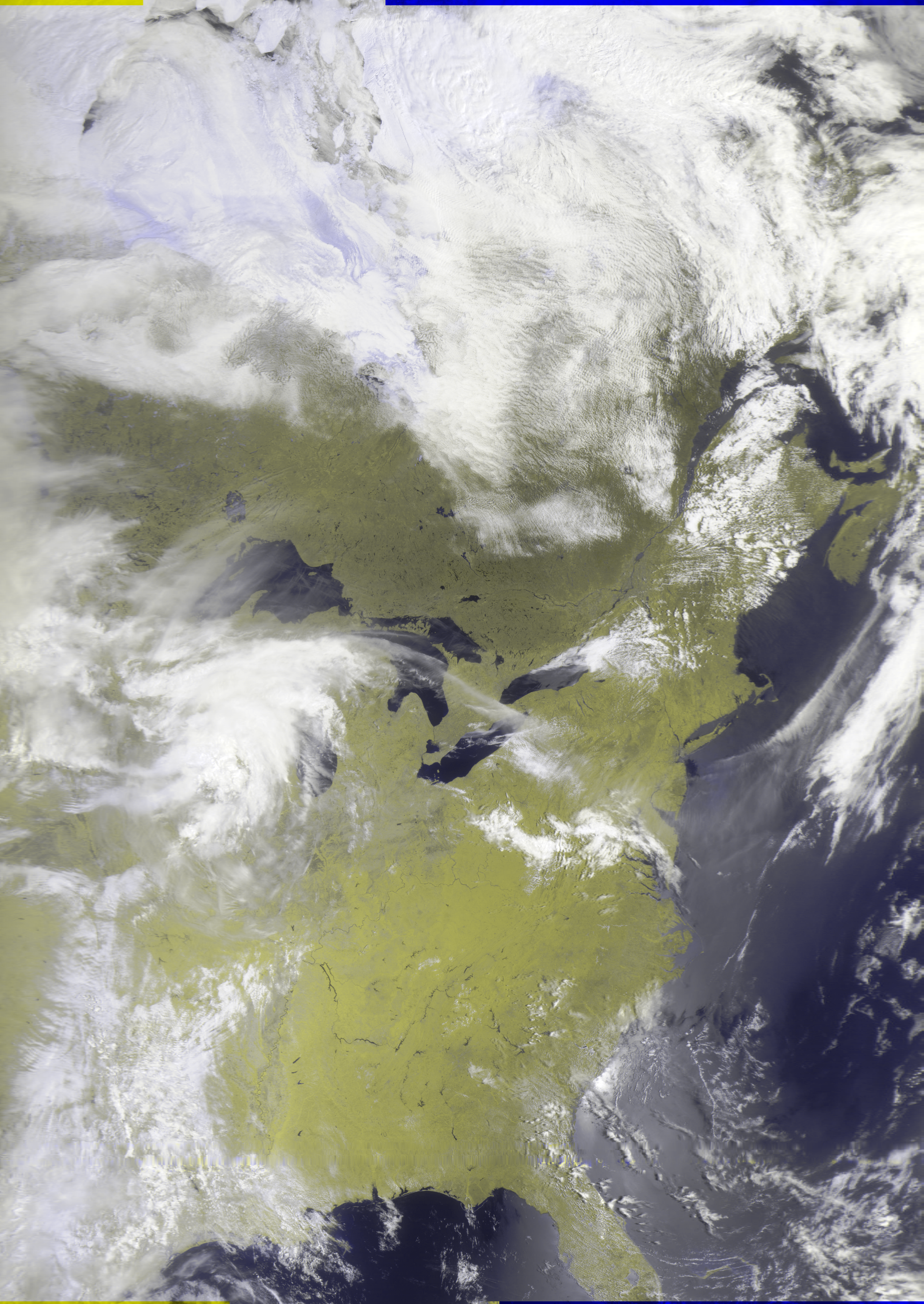
All of my captures: https://sat.vincebel.net/meteor-lrpt/
Quick terminology
SDR - Software Defined Radio. A system where traditional radio hardware can be implemented in software. More commonly, the term just refers to the little USB dongle you plug into your computer where your coax cable connects to.
VHF - Very High Frequency. The broad frequency range of 30 MHz to 300 MHz, which is easy for beginners to receive. FM radio also resides in VHF.
LRPT - Low Rate Picture Transmission. The digital mode in which the satellites in this guide transmit their pictures.
METEOR M2 - The satellites that we will be receiving LRPT signal from. They are run by the Russian space agency, and the two active satellites M2-3 and M2-4 are the only two remaining weather satellites that broadcast LRPT, or any weather imagery in the VHF band.
LEO - Low Earth Orbit. The altitude range that many satellites orbit in, including the METEOR M2 series satellites. When talking about weather satellites, LEO is usually in contrast to geostationary orbit.
What $50 buys
The quickest way to get started is to purchase an RTL-SDR + antenna kit, which includes:
- An RTL-SDR USB dongle (your "software defined radio")
- A V-dipole antenna
- Cables, mounts, and the other accessories needed
As of the time of writing, this bundle costs $49.95 on eBay. Either the v3 or v4 works, there's some technical/supply chain differences between the two that don't matter much for this.
There's a ton of stuff you can do with an SDR - from tracking weather balloons, to talking with others long-distance (with a ham license), and more. Satellite imagery is just one niche in the broader hobby of amateur radio. So if you're on the fence about buying an RTL-SDR, it could be the gateway to many more radio hobbies!
Antenna disclaimer: The starter kit will get you some pretty good images even with the default telescoping antenna, but the picture shown above was received with a better V-dipole antenna I built myself, with about $25 in supplies from the hardware store.
Software
Two programs you will need are gpredict and SatDump. They are both available for Windows, Mac, and Linux. gpredict is for predicting the next satellite passes, and SatDump is the magic software that processes the radio signal into the images, and provides some helpful tools for monitoring signal strength and doing error-correction to make the process a bit more resilient to brief signal loss.
gpredict blablabla. If you can't get this software working for any reason, SatDump has the ability to show predicted passes/elevations, but it isn't as great of a menu.